YCSPL provides a wide range of comprehensive drone surveying services in the private and public sectors. As new and refined methods of surveying are gaining momentum, our surveyors are adopting state-of-the-art equipment and innovative technologies. With the dynamic expertise and creative problem-solving of our team, we thrive to provide you with ground-breaking, timely solutions to the age-old challenges of surveying.
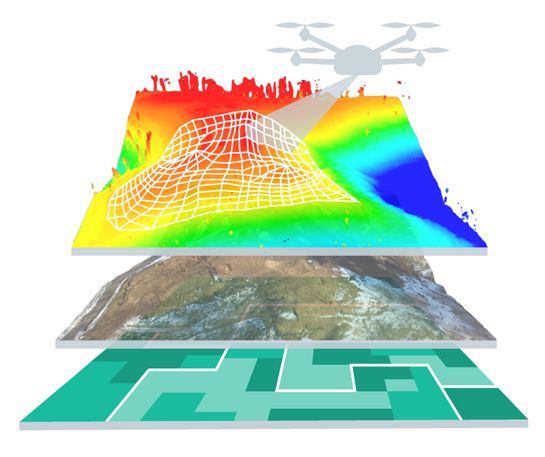
Apart from traditional methods, we are conducting digital surveying through mobile applications and utilizing aerial drones for mapping. These help us accumulate a large number of real-time data for our clients making the surveying process extremely precise. Our drone-powered and digitally driven surveying methods have extensively helped clients like government agencies, city planners, architects, and administrators for data collection amongst others. The drones we employ bear high-quality cameras docked with all the current features to capture the minutest of details that are impossible to capture with traditional surveying. Switching to the contemporary methods of surveying has helped us in cost reduction by saving on equipment and labor costs and automating data collection using drones with improved efficiency.


Re-inventing surveying through the use of aerial drones and mobile applications, our team of talented, well-read, and experienced surveyors will assist you with all the surveying needs of your organization. Be it traditional methods or innovative ones, be assured of quality and accuracy in our wide range of comprehensive surveying services.
We at YCSPL provide extensive aerial imaging and mapping services for the purpose of inspection and surveying a parcel of land. Navigating complex urban, as well as rural area projects, become much easier and faster with drones bearing high-resolution cameras, video cameras, and thermal imaging cameras.
Land surveying is essential for all construction projects before commemorating any process. To locate, describe, monument, and map the boundaries & corners of a parcel of land, surveying is performed. It can also include the topography of the land, the location of buildings, and other improvements made to the land.
With the increasing congestion in urban areas, this country needs a tactful and inventive approach to deal with urban planning in a swift way. We at YCSPL are here to help you endeavor this with an experienced team of urban planners bearing unparalleled industry expertise and hands-on experience.