Effective
Press Release

AXzxzzcx

News

Archives: Insights

Advantages of GIS (Geographical Information System)
September 14, 2022 /

7 Major advantages of GIS that you can’t miss

Geographical Information System refers to the system that schematically analyses any geographically referenced information and processes the same to offer crucial segment-specific insights. It involves capturing, processing, storing, and analyzing information aligned with the position of the subject on the surface of the earth. There are plenty of advantages of GIS that makes it one of the best innovation that’s changing the level playing field for a lot of business verticals. GIS predominately revolves around establishing, understanding, and manipulating spatial patterns and relationships.

Five components together make up to GIS

Hardware

Refers to the components that are utilized for the collection of information. Computers, graphic devices, plotters, and scanners are some examples.

Software

Refers to the tools and technologies that are utilized for the processing of the collected information.

People

Refers to the pool of resources who make the entire process possible with their innovative approaches and diverse field expertise.

Data

This is the prime component of GIS that makes it highly important for the present and future geographical data frameworks. Rasters and vectors are the two kinds of data that are sourced from GIS applications.

Methods

Refers to the overall schematic structure of the end-to-end utilization of GIS tools.

GIS applications aid in the curation of data-rich maps that can help you establish relationships and better communication between teams, departments, and fields.

The key advantages of Geographical Information Systems

1. Better decision making

GIS operations aid in improved data sourcing and helps us visualize a lot of crucial metrics that are important for niche project planning ventures.

GIS applications will help us with better subject matter knowledge of data points. For example, let’s take urban planning. Geographically sourced information will help us with zoning, conservation planning, route/corridor selection for highway planning, eco-conservation, and a lot of other operations.

Making the right decision with locational awareness is the key to meeting a lot of demands of the future. Having realized this, businesses are now increasingly employing GIS applications for better overall process efficiency.

2. Improved cost saving

Be it any project, the overall schedules, timelines, manpower involved and resource requirements can all be mapped with added accuracy with GIS services. GIS systems help with accurate predictions, possibilities, and probable outcomes even before project initiation and can thus help us eliminate the unknown while going about any business operation.

3. Marketing 0pportunities

Identifying geographical patterns and people relationships aids in better target audience segmentation. This will help any organization channel its efforts in the right direction and reach the right people who offer them improved prospects of conversion. Along with customer profiling, GIS also offers regional planning capabilities for added benefit in terms of target and regional selections.

4. Mapping

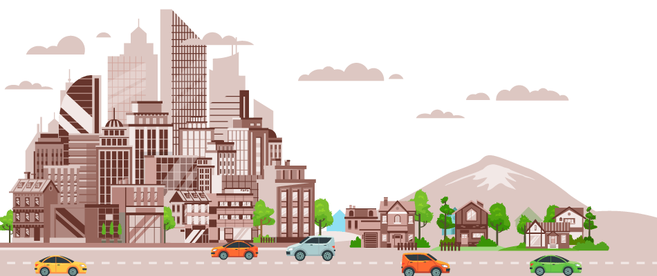
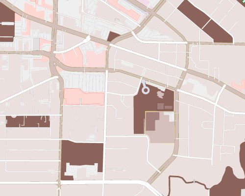
Mapping is one of the major applications when it comes to Geographical Information Systems. GIS systems are utilized on an everyday basis for various applications and API integrations. And these mapping applications are not just restricted to road maps but there are other utilities like topographic maps, aeronautical maps, and nautical mapping technologies.

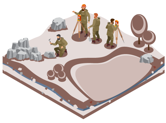
5. Natural resources management

Advantages of Geographical Information System

Proper introduction of GIS in combination with remote sensing technologies aids in identifying and locating natural resources. This is one of the major advantages of GIS that has been helping a lot of planners to conserve, preserve, and zone area that is prone to exploitation.

Even the identification of mineral resources and their quantity of deposits are possible with GIS.

6. Disaster prevention

Let’s take any event of natural disaster. They’re going to have huge impacts on life and property if there is no pre-planned approach to preventing its overall escalation.

Geographically sourced data can help us identify areas that are low-lying and are prone to escalated damages in the event of floods or heavy rainfall. There are also a lot of other applications including identifying areas that are prone to easy contamination in the event of a pandemic and the extent or severity of impact beforehand. Mitigation of the consequences is possible with proper strategies that are plotted with the assistance of GIS.

7. Information management

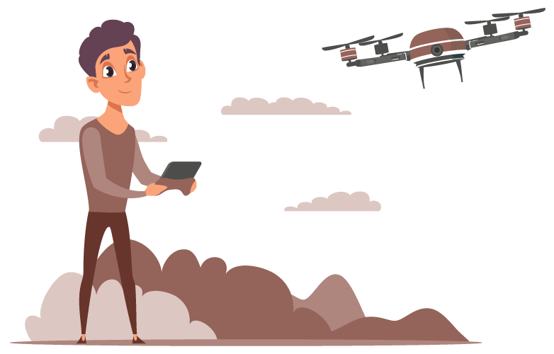
The overall process of compiling, handling, manipulating, interpreting, and distributing information is now easy with GIS tools. At YCSPL, most of our projects required a lot of ground surveys and basic data understanding which were all made possible because of GIS tools.

Governmental organizations and even large corporations are now increasingly collaborating with GIS planners for constructing a data framework and have a pool of information at our doorstep. It is transforming the way we handle and process information like never before. This is also thus strengthening communication and decision-making systems.

Day-to-day resource management is becoming increasingly easier with this sourced information.

Due to this abundance in terms of the advantages they offer, there are increasingly utilized in the fields of urban planning, agriculture, rural development, utility planning of a region, disaster relief, and prevention, etc.

At YCSPL, we have been working closely with a lot of organizations to meet their requirements ground up with impeccable GIS tools. Especially with urban planning projects since geographical information is of prime importance there.

Building a sustainable cityscape structure is only possible with historically sourced geographic information which can later be dissected to proper solutions.

Visit our website to know more about the advantages of GIS that we have been employing in action for various clients belonging to diverse niches.

Software development life cycle(SDLC)
September 12, 2022 /

The need for software development life cycle

Preparing a plan of action for the entire transit of your software will help you curate an end product that is functionally perfect. There is an increasing need for SDLC because of the increasing complexity of technologies. Since there are also going to be a lot of resources involved, you need to be increasingly cautious in making all their efforts happen in a coordinated manner without missing out on even the smallest of details.

When you hire an expert company to take over your software development for you, they’ll go about your requirements in an orderly fashion. Having a system in place will also help project managers to get the job done right in the given timeframe and to check all the boxes of requirements. System analysts and project managers generally utilized software development life cycles to outline, analyze, design, develop, and later deploy fully equipped finished products. The shortest possible turn-around can also be achieved with a systematic process.

7 Stages of the software development life cycle (SDLC)

The following stages are crucial and are absolutely necessary if you want to develop your software product in an impeccable fashion.

  • Planning
  • Feasibility Analysis
  • Prototyping
  • Development
  • Testing
  • Implementation and Integration
  • Maintenance & Operations

Let’s take a closer look at these stages to get an even bigger perspective of their importance

1. Planning

Here business owners closely work with developers to clarify all the preliminary details that are necessary before jumping into the process of development. Understanding the objectives and end goals while also paying close attention to the changing seasons of the market are all given attention and importance here.

Identifying the tools and resources necessary are also given importance here. The more work you do in the planning stage, the better will be your overall operational flow and development process.

2. Feasibility Analysis

software development life cycle

Integrating any new program into an existing infrastructure is always hard no matter the amount of progress they bring your way. Feasibility analysis will help you figure out if you absolutely need this software and all the revenue or cost-cutting they can offer your way. Here the nature of development, the functionalities, timelines, and overall process flow of the SDLC are mapped. This way the developers would be able to set the right expectations upfront and build a rapport with the businesses they work with right from the start.

3. Prototyping

This is the design phase which involves the determination of the overall look, feel form and functionality of the software. Any changes that you need in your end-product can be altered here so as to maintain development delays or other hindrances and back and forth.

Any software design that you go for should retain all the necessary UI/UX conditions over all else. This will ensure that the transition is seamless. There should be a whole lot of factors that are taken into consideration including storage, networks, databases, and user interface.

The design here is a logical structure of the end application that can later be programmed and developed.

4. Development

This is where your software gets its shape. The approved wireframes and prototypes of the application are programmed into a finished application here. With a proper communication loop, the entire process of development can happen seamlessly without any hindrances.

When you hire an expert like YCSPL, we’ll assist you with a dedicated project manager who will keep you updated on the everyday progress and will be available to take in any requests or changes at all times.

Common programming languages that are deployed include C++, PHP, etc but there are a lot of others that are being increasingly employed these days to meet the complex SDLC requirements.

5. Testing

The development process is just the beginning of what is about to come. Any developed software will just not be enough to directly create the impact that you’re looking for or offer the exact outcomes that you want.

A lot of testing, compromises, improvements, quality checks, and quick fixes are increasingly necessary for ensuring the smooth functioning of an application. The time involved in the testing phase purely depends on the complexity of the requirements.

There are also a lot of loophole mapping, bug fixes, and security updates that are done here to arrive at efficient software products.

6. Implementation and integration

Here everything from the hosting environment to the operational integrity of the software is all taken into consideration and presented to the businesses. Any gap in the functional and design aspects of the application is bridged here.

Developers and a back-end support team will walk the employees and the entire business through the application utility and help them transition from their existing processes.

7. Maintenance and operations

An SDLC is incomplete without this phase. Introducing software into the market might be one thing, but managing the overall performance of the software at any given point in time will offer a better overall solution unlike anything else.

There will always be an increasing need for better UI/UX as people improvise their taste with time and being relevant to the design trends is very important. The software maintenance phase also involves security checks, avoiding downtimes, server backup, strengthened security, etc.

When you hire someone diligent like YCSPL, you’re basically hiring experts to be in charge. We’ll take complete control through all these stages and help you bring your software vision to life in the best way possible.

We carry a decade’s worth of experience to give you the solutions that you’ve always wanted. Our experts might just be able to give you a better overall direction for your software requirements. Get in touch with us today!

Best digital transformation strategies
September 7, 2022 /

Looking for digital transformation strategies that can level up your business?

The competitive landscape of the business world is making it tough for any new market breakthrough to happen. It is thus important for brands to reinvent the wheels every now and then to steer clear in their approach. In order to establish your reach beyond the ordinary, you’ll have to let go of mediocrity and advance every core aspect of your business. Digital transformation strategies are now more important than ever since they can potentially give you an added edge to navigate your way through towards reaching more customers.

In addition to the reach digitization brings your way, it is also about improving your resilience, agility, and dynamic productivity as an institution. Improving your way of business is what digital means can offer solutions. According to a study by McKinsey, it is found that about 20 – 50 % of revenue gain and 20-30% improvement in overall client satisfaction can be achieved with well-planned and implemented digital transformations.

What does a digital transformation entail?

Realigning the entire business strategy by making the best use of digital platforms and means is what it takes for a complete transformation.  But enabling a transformation that presents cost-effective, time-sensitive, and time-tested solutions requires precision to details and complete experience. Companies like YCSPL make this happen for you seamlessly by following the best practices listed below:

1. Infrastructure modernization

Digital integration of systems and processes can help you take your operational excellence to the subsequent levels by supporting improved collaboration. Digitization might seem capital intensive but the solutions it brings about can reap you a lot of ROI in the longer run.

Modernizing your existing infrastructure asks for a lot of innovation to suit your processes and align them towards the same. On-premise environments when interconnected will result in giving a more agile avenue for performing your operations. Seamless data access, flexibility in process or project customization, and holistic operational integrity between the team are all possible with an intuitive infrastructure in place.

2. Innovation in methods and encouraging collaboration

best digital transformation

Innovation is the root of all progression but it doesn’t come as easy. On a tech level, it is important that you stay ahead of the curve and adapt to any latest progress in your respective business vertical. But be aware, that implementing new technologies without any long-term vision can disrupt the entire purpose of the initiative. Be it any vertical you belong to, you should keep a note of your consumer behavior, market appetite, and the general trends in their expectations to suit your offerings to their requirements.

Encouraging collaboration within the teams can help you curate a connected environment that aids in better productivity altogether. You’ll also be creating an internal environment where talents are recognized and innovations are welcomed. This will also indirectly improve the accountability of each employee and make them contribute to your progression as an invaluable asset. Empowering a culture of teamwork and unity will help you drive together as one towards common goals.

3. Leverage digital tools

Outdated processes like paperwork data management or excel sheets are only driving you down from the potential that awaits beyond. By integrating CRM tools, you’ll keep your customer experience top-notch simply by not missing out on loopholes of communication touch points. The end-to-end data keeping and documentation that digital tools offer can help you operate a lot more efficiently.

Strengthening your internal process eco-system will also help you visualize all streams of your business including accounting, HR, finance, and sales together under one roof. You should be making the best use of available resources like cloud infrastructure, data analytics platforms, collaborative project management tools, AI solutions, and other tools that enhance digital reality.

4. Bridging any risk or uncertainty

The best digital transformation strategies are not just something that introduces software or tools to business processes. But rather evolving the methods, purpose, and the entire premise upon which the organization operates.

Understanding your target customers and their changing preferences or the climatic changes in the business world should be a priority. And this only happens when you run behind data accumulation and introduce innovative data analysis methods to capture the message that will set a pace for the future.

Identifying pain points, and understanding your own case studies to build better processes should all be a part of your transformation. This will future-proof your organization and direct your efforts in the right direction.

What makes a strategy good?

Any good plan of action will involve a preliminary diagnosis to understand the existing process, find loopholes if there are any, and bridge them with solutions that can be brought about digitally. Simply integrating a tool or two is not what digital transformation services are all about.

Building a coherent plan that will set a pace for the future of your brand is what it is all about. There should also be a proper SWOT analysis that is done to understand different segments of your business and there should be a guiding policy that is developed to lead you with your ventures.

Hiring a company with sufficient experience to take care of your digital transformation strategies will give you a better shot at doing this right. There is going to be serious investment involved when you realign everything you previously know towards something entirely different.

At YCSPL, we are here to consult, strategize, develop, implement and help you with the complete integration of new processes for the better.

What is architecture?
September 6, 2022 /

Wondering about architecture?

By definition, architecture is the practice of designing construction plans that will aid in the further development of buildings. But the scope of architecture goes way beyond this. For people who are in the field practicing, the definition is not any simpler. The question is an artistic puzzle that will incite intellectual interference to find an answer.

Artists are people who take real-world examples and represent them with abstract essence. Architects on the other hand come up with abstract ideas that are then brought to life.

The profession involving the designing of the plan for buildings, constructions, and environments with an added aesthetic touch is what architecture is predominantly about. The scope of architecture generally deals with designing layouts, sketching blueprints, adding essence to construction, supervising the building development, and restoration of old structures or remodeling.

For artisans, the question ‘what is architecture?’ is an intellectual debate. Architecture to them is rather a calling or even a passion that cannot be labeled by a singular definition.

Elements that architects should deal with

Designers in the field of architecture deal with the creative manipulation of many elements to arrive at structures and solutions that are functional and beautiful. Mass, volume, light, space, material, etc along with other considerations of cost, technology, and constructive to arrive at solutions that are functional, artistic, and carry an aesthetic appeal is what they have to focus on.

And architecture is a field where a one-size-fits-all approach definitely bites to the dust. There should be consideration of surrounding structures, community, history and heritage of the given locality, climatic conditions, budget, development timelines, and materials.

The end purpose of architecture comes down to designing buildings to life that are sustainably constructed, offer the flexibility for reconstruction in the future, be energy-efficient, accommodate all the functional requirements, and also age well with time. Form and function should be two major elements of focus.

Contemporary day-to-day conditions of livelihood should all be a core consideration for the development of any structure. Serving the collective interests of developers, politicians, corporation, and end users are hindering the artistic freedom of expression that architects originally want to express. But it is also an obligation of the field.

Architects generally employ scientific methodologies, abstract thinking, and artistic sensibility to create great solutions.

Principles of architecture designs

1. Balance

Creating an equal weightage to all design elements while also retaining the functionality of every last corner is what balance is all about.  This balance can be met in both symmetrical and asymmetrical contexts. Symmetrical balance involves the equal composition of all the elements surrounding the center of balance. In an asymmetrical composition, the elements will not be evenly positioned by the center balance but they all meet integrally at a specific point away.  Visual equality is basically what balance is all about.

The symmetrical balance again can be classified into the following:

  • Balance along the vertical axis
  • Balance along the horizontal axis
  • Bi-axial balance
  • Diagonal axis balance
  • Approximate symmetry
  • Inverted symmetry
  • Radial symmetry

Asymmetrical balance can be classified into:

  • Balance by texture
  • Balance by color
  • Balance by value

2. Rhythm

Repetition, Transition, graduation, and Opposition are some of the components pertaining to the rhythm. A mix of visual components together creating a recognizable pattern is what rhythm refers to.

what is architectureRhythm in the design brought about by repeating shapes, lines, or colors is called repetition. The rhythm created by a gradual change in color is called gradation. A central axis with elements protruding from it is called radiation. An abrupt visual change that still makes contact at the right intersection to create a rhythm is called opposition.

3. Emphasis

Assorting a visual hierarchy to finish designs to highlight what needs added attention is referred to as emphasis in architectural terms. Visually conveying a message with key highlights in finished construction by making distinctive elements stand out is what this principle deals with.

Making one area stand out for an added visual appeal is something that makes architects retain their individuality through a creative style of expression. At YCSPL, we have experts who are extremely perfect with the attention to detail they bring about in any design.

4. Visual movement

The progression of any design visually to appease the end-user’s perception is called visual movement. Playing around with spatial connections to result in a unique flow of design elements is what makes a good architecture with visual movements. Direction movement aligning the visual course of the perceiver makes any exterior look futuristic with a unique aesthetic appeal.

5. Contrast

Contrast aids in emphasis and brings objects or elements forward in a design. Contrast can be made of colors, shapes, compositions, or even sizes. The key challenge for any architecture company here is to engage in contrasts without disrupting the unity of the design.

6. Harmony

The unity or order of a design that creates a visually pleasing structure is what harmony refers to. This makes the entire development agreeable as a whole.  Creating a visually satisfying effect will make any structure looks extra aesthetic.

Only when a design carries a functional unity, they’ll also express a sense of evenness in its style.

7. Alignment

A certain order of arrangement to bring together different elements to feature as one is what the principle of alignment is all about. Any kind of organization will add up to the look and feel of any area and create a pleasing outlook.

Principles of urban planning  
September 5, 2022 /

Top principles of urban planning that every humanitarian and planner should keep in mind

Urban planning enhances the look, feel, and living experience of any city. And this happens when the considerations go beyond just infrastructural developments. The core focus should be revolving around a whole lot of other considerations like self-sustainability, creating local neighborhoods, bridging economic inequalities, and efficient management of resources. The principles of urban planning should foundationally focus on making the cities futuristic and accessible with a lot of opportunities everywhere.

Engineering, surveying, mobility planning, and architecture should all be combined effectively for arriving at proper urban blueprints. Before going into the principles, let’s look at a few objectives of urban planning before getting there.

The basic objectives that should be met by urban planning

1. Health

There should always be a people-first consideration in practice that enable efficient living conditions everywhere across the cityscape. Zoning a city into residential, institutional, recreational, commercial, and industrial areas. This will avoid encroachment between the zones and thus conflict an orderly development or smooth functioning.

2. Sophisticated beauty

Cities should always attract a lot of migration because of the ample opportunities they provide and also for the living experience they deliver. Any infrastructural development should pay added attention to the cultural history of the existing area before revitalization. This will enhance the existing structures while also retaining the essence of what the city stands for.

Everything from the aesthetic finish of the buildings, the distinction of civic bodies from the other buildings, adding a touch of greenery wherever permissible, preservation of trees, and preventing complete exploitation of any natural bodies should all be given careful thought while going about urban planning services.

3. Connective sense with culture and environment

Cities should retain the essence of cultural roots that have been long-standing in the locality. This will make each city distinguished from one another. This will also improve the aesthetic sense with a unique appeal. At the same time, citizens are most likely to spend most of their days in the rush hours and do not spend as much time outdoors. They’ll lose their sense of connection with nature and the environment with time. This will decrease their overall harmony of life and living.

It is thus important that urban planning authorities should rely key focus on building public spaces and outdoor setups where people can take a breath and relax with natural outlets.

4. Convenience

A 15-minute city should be one of the primary objectives during development. This is basically where a citizen can find anything they want and all the essentials they’re looking for within a 15-minute walking or cycling distance within. This will create a sustainable city-dwelling life and reduce the need for long-distance transportation. These local neighborhoods will also bridge any economic inequalities between the two regions within the city. Public amenities, recreational centers, and outlets for socializing should all be accessible to every last citizen of the city structure.

Principles of urban planning that you can’t overlook

1. Zoning

Only when a city’s landscape is dissection into different zones, there will be room for comprehensive development while also not being at a cost to one another. There should be separate areas dedicated to industries, commercial structures, residential facilities, etc. This will make each area independent in its function and also not disrupt the harmony between two localities or neighborhoods.

2. Green belts

Even if cities are only known for their high-rise buildings and constant buzz, it is necessary that you preserve any greenways there are in the nearby regions. Segregating green zones will help us prevent mass exploitation of land and commercialization of structures that needs preservation. Any lakes, ponds, reserved forests, river beds, or other regions should be excluded from any development plans. There should also be proper conservation plans in place to revitalize existing natural structures before they’re exploited beyond repair.

3. Road network

Roadways especially in cities are going to face the issues of congestion and endless traffic if they’re not planned right. The hierarchy of the road structure has a direct effect on the aesthetic appeal of the cities.

principles of urban planning

Hindrances like an irregulated road full of traffic issues or potholes are going to ruin the living experience of people and make commuting a real problem.

4. Mobility solutions

There are going to be a lot of working professionals who’d be commuting from one place to another on a day-to-day basis. They should have a lot of options and a hassle-free journey experience. This will improve their perception of city life and also makes it easy for them to navigate their day-to-day life. Infrastructural development proposed by any urban planning company should focus on the efficient integration of public and private transportation networks to make commuting across the city easier.

5. Inclusive developments

Focussing on progressive development and inclusivity should be the core principle of urban planning. This will make sure that the city is free from any division in terms of gender, race, or physical abilities. A simple example would be to plan to have wheelchair accessibility in all the public gathering areas or gender-neutral bathrooms for people on the spectrum.

6. Community Welfare

Social and communal outlets should be given importance during infrastructural development. Promoting communal harmony among the citizens will only be possible if there’s a possibility for them to interact with each other.

At YCSPL, our urban planners carry years of experience and they’ve been working closely with the governmental organization to carry out effective development strategies.

What are the components of GIS(Geographical Information System)?
September 2, 2022 /

Diverse components of GIS are now taking the world apart!

Geographic Information System (GIS) is a technology that has the ability to process thematic geographic layers and deliver data-rich maps and analytic insights. They help in both statistical visualization of a geographic region and also offer geological trends as well as other understandings through maps. Every components of GIS is carefully integrated together for solving a whole lot of real-world problems.

GIS also opens up a world of opportunities by helping us understand, interpret, visualize data, and question any patterns, trends, or relationships geographically through a wide range of reports, maps, and charts. They help us understand any data quickly by simplifying it in an interpretable format. This is one of the reasons why they’re widely used as a problem-solving tool both by governmental bodies and private organizations.

They also offer multi-disciplinary solutions in diverse fields like Remote Sensing

What are the components of GIS?

There are five key components that aid in integrally helping GIS utilization possible. This includes hardware, software, people, and data.

1. Hardware

Hardware refers to the computer, graphic devices, scanners, and plotters that are used by the end-user to operate GIS. There are advanced desktops and centralized servers that are used both as networked or individual stand-alone configurations.

2. Software

With the internet having a massive reach and potential, there are now a lot of web-based applications that are deciding the GIS system architecture.

Software refers to the tools that are required for storing, displaying, processing, manipulating, and analyzing geographic data. There are several well-established Database Management System tools, Graphical User Interface (GUI), etc that are available for performing GIS operations.

3. People

GIS operations are essentially happening because of people who can process the collected information and manipulate them to offer us crucial data insights. Solving real-world problems by making sense of the collected data combined together is only possible because of all the technicians and specialists that are doing this.

At YCSPL, we are fortunate to have all the resources that we need who can bring the best of innovation to the table for arriving at instant solutions related to GIS utilities.

4. Data

The integration of spatial data with other resources or a DBMS is one of the prime components that enables GIS systems. Any definable relationship between spatial points can be essential data. Traditional cartographic maps, demographic statistics, hard-copy data, geographic reports, etc are a few examples. Spatial data collection is now being done accurately with the help of new-age surveying equipment like drones and they’ve made way to standard base maps (digital) being available to scale.

The data here is stored in the form of thematic layers. The two types of GIS data include:

Raster – Here the collected data is stored in the form of rows and columns.

Vectors – Here the collected data are in the form of points, polygons, or lines with vertices attributes.

Applications of GIS

Almost every industrial vertical there is are directly or indirectly on a day-to-day basis. Here are a few top applications that you cannot miss knowing about.

1. Mapping

The visualization that GIS offers is the major reason for its overall popularity. Google maps is a product of GIS services and we are practically using it every day for navigation its API is utilized almost in every application.

2. Agriculture

components of geographical information system

Through various data processing techniques, GIS can give a clear picture of a lot of geological conditions, weather patterns, and crop rotation planning. They also help identify trends of drought or flooding to mitigate any losses by preparing up ahead. The agro maps derived from GIS data help us to understand crop resilience towards climate change, erosion productivity impact calculation (EPIC), farming trends history identification, real-time crop yield calculation, pest attack trends, etc. All these can collectively improve the quality of yield and productivity of farming techniques.

3. Disaster mitigation

They serve very good data understanding about a lot of climatic phenomena, environmental conditions, the occurrence of droughts or floods, disease pattern identification, pollution monitoring, etc. They can thus help us identify any impending risks and help in risk aversion ahead of time.

With irrigation management and crop forecasting application of GIS, it is also possible to reduce the incurrence of losses in the agriculture and farming landscape. They also help in limiting any outbreak of diseases in particular regions and prevent their escalation by containing them from within.

4. Urban planning

Urban planning involves a thorough understanding of spatial data, their relationship with the surroundings, and other socio-economic planning. Every component of GIS together aids in pattern analysis and devises plans that cover every last detail.

Cities are the economic powerhouse of any country. It is thus important that they’re resourceful and offers improved access to their citizens in all respects. With GIS data, it is possible to understand a lot of mission-critical data like the economic differences between regions, resource availability, permissible land planning, etc. All these are essential for urban planners to design, develop and deploy structures that are self-sustainable and yet futuristic.

At YCSPL, we have been deploying GIS solutions ever since their inception years ago and have been closely associated with a lot of projects at scale. Our expert technicians have years of hands-on experience and they present the best solutions for even the most complex of industrial problems.

GIS is the present and they’re rapidly evolving to be more futuristic each day. Keeping up with the latest trends might help your business just stand out.

How does drone surveying work?
September 1, 2022 /

Everything you need to know about drone surveying working

Drones are new-age tools that are powered by advanced technologies. It is rewiring the entire landscape of the mapping and surveying industry. These offer a lot of data-rich insights in the areas of photogrammetry, 3D mapping, land surveys, and topographic understanding. Industries are now running after understanding the end-to-end functioning of drone surveying working to implement it for their benefit.

So, what is drone surveying?

The process involving the determination of positions and distance between two spatial points in a 2D or 3D space is what surveying means. Deploying drones for the process is what we refer to as a drone survey.

They offer critical information that helps property managers make informed decisions with respect to property boundaries, infrastructure data, and construction planning. Since drones are deployed aerially, they’ll get through any hindrances. It is also possible to mine data sources from areas that are practically inaccessible.

How does drone surveying working?

Drones are deployed aerially and they fly at specific heights above ground level. They are equipped with payloads that carry precision-rich RGB cameras that are multispectral. These aid in capturing images and videos from the above.

They are also featured with other sensors and LiDAR payloads which aid in collecting data points that can then be processed to collect a lot of valuable information. The payloads help in capturing aerial images from different angles and each angle can be tagged with geographic coordinates.

Coupled with GIS systems, they can aid in complete visualization and mapping out locations. Drones in operations today are technologically advanced and can aid in collecting real-time data. They can now fly up to 10 km even in the roughest of terrains or weather conditions.

When you work with expert drone companies like YCSPL, they’ll offer you precisely on-point data that are completely reliable. The location accuracy of drones is accurate up to 2cms. For this reason, drones are rapidly replacing the age-old surveying methods and are increasingly sought after.

Deliverables to expect from drone operations

1. Orthomosaic maps

Through image distortion and stitching together techniques, drone images are processed post-flight operation to generate orthomosaic maps. These are highly accurate to every last pixel and help us with a thorough understanding of 2D spatial information.

2. DTM

Digital Terrain Models (DTM) help in capturing data b filtering unnecessary data points like buildings or other structures. This will give us X and Y coordinates of a complete region along with the highest altitude reference in the area thus giving 2.5D information.

3. DSM

Digital Surface Models (DSM) help in surface mapping with latitude, longitude, and highest altitude coordinates of the specific region despite the accessibility, physical structures, or terrains.

4. Thermal maps

how does drone surveying work

Drones can be helpful in identifying temperature anomalies in mission-critical areas. They are thus handy in offering surveying solutions for complex facilities, industries, military bases, or even cityscapes. Supply pipes, heat exchange units, hot water lines, condensation return lines, etc can all be effectively and accurately monitored for ensuring added safety in operations. This will also help in easy recuperation and disaster aversion in these areas.

5. 3D Textured mesh

This represents the drone data that are reproduced for arriving at precise vertices, textures, faces, and edges of any given area that is shot aerially. They help in the inspection of areas, property management, etc among other things.

What areas do they help?

1. Land surveying

Drones can help in generating accurate 3D models of any area. They can thus help in land surveying processes for generating the above-mentioned deliverables. A land survey is essential in monitoring the topographic nature of the given space. This will give us an understanding of their geological positions, if they’re prone to vulnerabilities like flooding, construction of roads, infrastructures, bridges, or pipelines, and even give insights with respect to farming. Accurate drone surveying working data will help us keep track of new constructions and see if they fit in with the existing plans that we have in place.

2. Stockpile volumetric measurements

Drones surveying methods are now being increasingly popular in the industrial segments for stockpile measurements and analysis. Since drones can capture topographic data of any anomalous space, they’re strategically deployed to capture volumetric measurements. The advantage here is that they do not give an estimate but the actual volume assessments. They’re thus used extensively in the fields of agriculture, mines, and inventory of other fields.

3. Slope monitoring

A combination of Digital Surface Models, Digital Terrain Models, and LiDAR survey data will help us with effective and efficient monitoring of any rough terrain or slopes. This will help us mitigate the disasters that are prone to occur when slope failure happens. Drone thus helps in the aversion of a lot of geologic hazards this way.

4. Urban planning

Urban Planning deals with the comprehensive design, development, and execution of smart infrastructural plans that pave the way to a better cityscape infrastructure. With GIS utilities and drone data combined together, you’ll be able to better plan any advancements by paying close attention to the prevailing social or environmental conditions.

5. Defense

They are commercial drones with advanced payload configurations that are utilized in the areas of border surveillance, traffic monitoring, risk identification, etc.

At YCSPL, we have been closely working with governmental organizations and partnering with industries belonging to different verticals to arrive at solutions using advanced drone deployment plans. We definitely think the future of drones will open us up to a world of difference!

What is urban planning?
August 31, 2022 /

Urban planning explained

The entire humanity is rapidly progressing in almost every avenue there is. Designing environments that meet the needs and requirements of different communities and settlements are thus integral for any further development. And this is where Urban Planning plays a huge role.

Urban planning refers to the design and development of cities to meet comprehensive solutions for various requirements like transportation, communication, accessibility to resources, distribution networks, and other infrastructural needs. The primary concerns that are taken into account while planning these efforts include public welfare, ease of accessibility, and the general well-being of the citizen.

In recent times, urban planners are cautiously developing structures that are futuristic and at the same time sustainable in nature. Bridging any inequalities and socio-economic divisions within the same region is also a key focus to developing a collaborative community that functions as one.

Some of the key factors that are taken into consideration while urban planning in India:

1. Creating designs for the ‘tomorrow’

Cities are futuristic already and for any further developmental planning, you need to arrive at time-tested solutions that will also be enough in the near future. Be it the addition of new neighborhoods or making integral developments to existing regions, meeting the goals of the requirements we might have in the future should be the key focus.

2. Pay attention to the social, economic, and physical environments

Social – Be it revitalization or expansion plans, the social fabrics that hold the city together already should be considered. The existing conditions of the communities in the region, the resources they require, and mobility solutions for easy transportation should all be considered.

Physical – The geological history of the city should be understood before the urban planners dwell on land use planning. Terrain maps should be dissected with careful GIS operations to better understand the region before making any massive plans for change.

Economic – Cities are undeniably the drivers of change and they are the potential economic powerhouse that can drive the country forward. Trends like employment, and accessibility to job opportunities, should all be considered by urban planning companies. There should also be ground floor planning that will help small businesses thrive and help drive a change forward.

3. Planning for the pedestrian

Urban life is soulful and the experience of cities is one other reason why there is always a constant migration towards the same. Planning for the pedestrians will involve considerations like the wind, ground floor planning, sidewalks, and roadside parks that will keep them actively engaged with the surrounding.

4. The 15-minute city

The 15-minute city concept basically helps in building the entire cityscape to function as one. The idea here is to create ample opportunities in every part of the city and create local neighborhoods that run on a self-sustainable basis. All the amenities should be available within 15-minutes of walking or cycling distance in each of these neighborhoods. This will reduce complex problems like mobility accommodations for a vast majority of citizens who are forced to travel across the city for work or other requirements.

5. Inclusive developments

Companies like YCSPL are forward-thinking in their development ideas. Inclusivity despite the economic positions, gender, race, etc should be the heart of cities while will driving forward a community that functions as one despite their differences.

An example of inclusive development would be to have gender-neutral bathrooms in public spaces, wheelchair accessibility in areas like malls, parks, or beaches using appropriate ramps, etc

Concepts involved in urban planning:

1. Strategic Urban Planning

When it comes to the question ‘what is urban planning?’, the trues answer would be to create a city that will attract migrations from all the other regions. Cities should be developed for looking up to and entice people in every aspect.

There are hindrances to this like overcrowding, unaffordable housing, transit facility limitations, etc. Strategic planning should eliminate these cons of the urban regions and focus on building a better environment that is convenient and comfortable in all respects.

2. Land-use Planning

This is one of the crucial types of urban planning concepts since they contribute to the complete utilization planning of the regions.

urban planning

The plans here should address issues that address all the infrastructural developments. You should also be focussing on preserving specific zones, limiting complete commercialization by focusing on creating open spaces for communal interactions, etc.

Land utilization is also done in stages that may be residential, commercial, municipal, or industrial.

3. Master Planning

Creating development plans for areas that are being newly transformed and building new structures on fresh lands is what master planning involves. They are vital because they set a basic framework for any neighborhood that is newly undergoing developments.

Here land owners, governmental organizations, and municipal authorities should work in collaboration to envision the requirements of the future and curate developments accordingly.

4. Revitalization Planning

It is important that any urban planning design thoroughly pays close attention to all the existing aspects when it comes to revitalization planning.

This generally involves giving the neighborhood a fresh outlook by modifying the existing structures and building new construction.

At YCSPL, we have been handling projects of scale and have been partnering with various governmental organizations in executing impeccable urban makeovers. Our eye for detail has made us stand out in the industry for over 15 years now. Building genuinely smart and sustainable cities are our core focus.

What are the different types of utilities?
August 28, 2022 /

The types of utilities in construction

On a general note, site utilities refer to the infrastructural constructions and features that facilitate some of the functional aspects of a building. The general types of utilities include the facilities like water, fire hydrants, stormwater facilities, sanitary disposal arrangements, etc. All these should be a part of the original blueprints.

When it comes to utility in business, it simply refers to an entity that’s offering these services as a door to door services. But since there is a chance of a monopoly situation here and since these are a part of essential services, there are strict regulations around. The most likely governmental intervention with proper protocols is regulated here.

Basis utilities like water, gas or electricity are absolutely essential services. They even play a key role in the socio-economic development of any region in question. And since there are a lot of competitors now in the utility sector, there is a framework structure for their operational regulations. This is to eliminate any anti-competitive practices and to keep the pricing justified.

The common goal in the sector should be to enhance resource accessibility across communities. The organizations in the sector should promote the freedom of associations and also prevent collective bargaining.

Here’s a quick look at the different utility types that you should know about:

1. Water

This is the most basic utility that should be a prior focus when designing an infrastructural plan. If the region is at risk of groundwater levels, then the local authorities or the planners should hire water services. This is applicable for both commercial and residential premises.

2. Gas

Gas utility refers to the companies that are authorized to provide gas services for heating purposes to replace electric consumption. This can be for both commercial and personal usage. There is a strict government intervention here in terms of subsidiaries.

3. Electricity

different types of utilities

Power is a fundamental need almost everywhere. India’s electricity sector is very dynamic in nature. The power produced in the country is predominantly sourced from resources like coal, natural gas, hydro, oil, lignite, and nuclear power. Some of the major players in the power regulation sector include Adani Transmission, NTPC, Powergrid, TATA Power, JSW Energy, Reliance Power Ltd, etc.

4. Sewage

Sewage utility refers to the systems, structures, plants, and treatment services that offer wastewater disposal arrangements. This is important to retain the sanitary aspects of any grid. Usually, municipal authorities take charge of this in the cases of residential areas to make sewage systems accessible for different communities and localities in a proper way.

There are a lot of surrounding rules and regulations with respect to the disposal and recycling of grey and black waters. When it comes to commercial premises, there are also frameworks to devise proper in-house treatment facilities to contain the level of waste generation. All these will help in leveling up our community together towards sustainable improvements.

5. Internet

The Internet has become one of the highly demanded commodities these days and there are a lot of utility providers in this segment. It is still not regulated as a utility such as water or electricity. There are a lot of Internet Service Providers (ISPs) that do not have stringent utility rules in terms of their prices, plans, or business structures. But it is not going to be long before that evidently happens.

Given the pace of connectivity and progress that we are running after, this will be structured under the types of utilities to protect the end user from pricing abuses by service providers.

6. Communications

When it comes to the question ‘what are the different types of utilities?’, the answer can be pretty straightforward in the older times. But now we are increasingly relying on commodities that improve connectivity among individuals and they’re one of the life essentials that we can’t really survive without.

Communication utilities include coaxing, copper, wireless and fiber connections that aid in telecommunication services.

7. Computing

Utility computing is a service provisioning model. It is focused on providing computing resources on a pay-per-service model.  This makes IT resources like travel reservation services, online retailing, etc easily accessible as need be.

Companies like YCSPL help in facilitating these types of utilities and aid in easy management of the processes. Our company acts as intermediary support in managing the interaction between the end-users and the government organizations.

Best city development strategies in 2022
August 26, 2022 /

Top city development schemes that you should keep an eye on

Only when cities are committed to driving a change, we can leverage the opportunities that are globally available. Policymakers, architects, researchers, and political city heads should all work in collaboration toward city development. Driving the urban population towards being more resilient, smarter, and sustainable should be the underlying idea of any development venture.

There are a lot of ongoing globalization and urbanization trends around. And it is important to understand that there is no one recipe or a one-size-fits-all approach that can be chased after. The culture, existing population, and communal harmony should all be taken into account while making an infrastructural shift.

With the remote working model still gaining increased popularity, this brings into question the need for people to live in cityscapes. Affordability, overcrowding, and a lot of other factors might prevent people from migrating. Cities should thus shift their approach and proceed towards development in a community-driven model that is inclusive, healthy, and convenient.

Here are some of the top priorities and trends that are setting the future standard for city planning:

1. Green planning – For people to keep in touch with natural outlets

Cities are generally highly dense in population and they keep buzzing all day long with commercial activities. People tend to lose their sense of belonging to nature.

To revitalize this, urban planning authorities are now keen on paying attention to public spaces. These can act as a center for social life while also helping people take a break for rejuvenation. Also, the lack of green spaces practically makes the entire space unhealthy.

These nature-based connections also provide an outlet for outdoor activities among children. Corridors for walking and cycling also help in strengthening the decarbonization agenda that cities are bound to pay attention to.

2. The concept of a 15-minute city

The idea here is to make a city and its citizens completely self-sustainable. Perfectly planned city development strategies will most likely take a lead on this one. Building a neighborhood approach to avoid class distinction within the cities or any economic inequalities is the idea. Every amenity should be accessible within a walking or cycling distance of 15-minutes.

This decentralized model will help in establishing local neighborhoods across the city with all the basic requirements fulfilled. There is also a transportation problem that arises if there is a fragmented urban situation. Hyper localization will instead rewrite this by providing the citizens with everything they need nearby.

3. Solutions for amplified mobility needs

Owing to the rise in population and increased migration of people towards cities, there is always a problem with transportation. Any city development blueprint should look into transportation as a core need.

A connected infrastructure with improved, sharable, and sustainable mobility solutions is what a futuristic city demands.

With 15-minute cities, the need for these long travels can be avoided. And decarbonization should revolve around promoting shared transport facilities and advocating for electronic vehicles.

Cities like Delhi have already been struggling with carbon neutralization. They’re now dealing with an odd-even approach to limit the utility of cars. We should be looking far beyond to develop solutions that are accessible and convenient too.

4. Inclusiveness

city development strategies

Cities are becoming neutral areas that are inclusive in terms of sex, sexuality, employability, and economic conditions. City development strategies in 2022 should advocate equal participation by providing improved access to infrastructure and housing needs.

Cities should be an example of communal coexistence and fight for maintaining a society that’s just. Basic needs should be affordable for people from all backgrounds.  There should also be a lot of accessible outlets for the elderly to relax and for children to indulge in activities.

Boosting employment opportunities and opening up to communal activities like marathons can improve society to be one.

5. Increased privacy awareness

When it comes to cities, data is going to be the most expensive commodity of them all. Cities should brace themselves with proper data concerns, and privacy awareness. They should also be equipped to face any impact of cyber attacks and bring the situation under control as quickly as possible.

The basic premise of smart cities is the interconnected environment that it provides. Mitigating any impact and containing any vulnerability beforehand should be a focus. There is an operational intersection that is more common in city structures and the complex connection between technologies. Cities executives should also have a cautious eye out to handle any scale of invasion and prevent the ripples they create.

6. Encouraging local production and a circular economy

The reuse, recycling, and restoration of any primary resource should be encouraged among city-dwelling citizens. The circular economy will thus help us live in harmony as a sustainable community that accelerates change.

Reducing food waste, electricity consumption, and water usage should be a priority. Proper recycling rules and regulations should be made mandatory for commercial properties.

Efficient energy utilization and adoption of renewable sources should be advocated among the urban population.

There are several urban planning companies like YCSPL that are increasingly working in collaboration with various state and central government authorities. They are together planning towards improving the infrastructures of cities and are making them inclusive in all respects.

The more we plan towards enhancing urbanization, the better will be our overall economy. Cities are the financial powerhouse that has the potential to generate tremendous opportunities. At YCSPL, we have been closely associated with a lot of urban planning projects.

How can we help you?

Change becomes the most dynamic, powerful source of progress you have

Get in touch with us