Effective
Press Release

AXzxzzcx

News

Archives: Insights

Frequently asked questions with respect to drone surveys
August 23, 2022 /

Digital survey is getting a lot of traction. Here’s everything you need answers for:

Drones are becoming an increasingly popular technology that is helping people with a wide range of applications. The aerial survey that drones offer along with the accuracy of data is why they’re being widely deployed for a range of inspection and survey operations. Drones also open up a lot of avenues for the digital survey and it is possible to carry out topographic studies in no time. The highly accurate measurements that they present within a fraction of time greatly reduce the workload and time involved.

Some of the frequently asked questions with respect to the drone industry:

1. What is a drone survey?

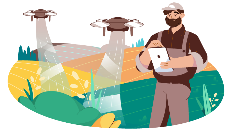
A drone survey involves the deployment of drones with downward-facing cameras and sensors to capture geographical data aerially. They can be used for a wide range of applications including land management, mapping, stockpile volumetric assessments, GIS applications, urban planning, terrain assessment, etc.

2. How are drone survey operations beneficial?

Drones enable us to capture accurate topographic data of even vast surfaces at a speed that’s 5x faster than the land-based traditional methods. Since the operations happen aerially with the help of a payload camera, there is a lesser need for manpower. Drone surveys in India can be done even in the toughest of terrains or inaccessible areas. They also provide an exhaustive amount of data and they’re all accurate to the point. Aerial mapping also makes the whole mapping operation a lot simpler.

Not to forget all the benefits they offer in terms of GIS applications. Together, drones and GIS have been helping us all progress immensely in a lot of diverse fields.

3. What are the data deliverables that can be sourced from drone operations?

Depending on the payload configurations of the drone or the software used, there can be a lot of data points that we can process from the collected information.  Orthomosaic maps, 3D point clouds, digital terrain models, digital surface models, contour lines, and 3D textured mesh data can be sourced from the digital survey.

4. What is the difference between UAV, RPAS, and sUAS?

UAV is an acronym for Unmanned Aerial Vehicle. RPAS stands for Remotely Piloted Aircraft System. sUAS stands for Small Unmanned Aerial System. All these are different from one another in their mode of operation, payload configuration, and applications.

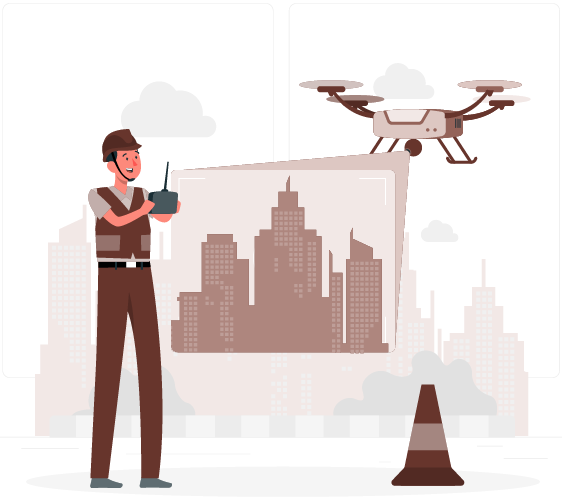
5. Do I need a license for flying a drone in India?

You should get a remote pilot license to fly a drone for any purpose in India. Non-commercial operations of micro-drones weighing up to 2kgs can be operated without a license.

There is no requirement for flying a drone in India if you’re deploying it for testing purposes within the premises of an educational entity. This is applicable if you’re registered under the central government as a drone manufacturer or a start-up that’s recognized by the DPIIT or if you’re authorized as an entity to carry out any testing within the green zone.

6. Are there any restrictions with respect to flying drones at night?

As of now, there are no particular regulations on the timing of flying drones in India. But night-time drones should be fitted with add-on safety implications including anti-collision lighting and a return-to-home feature in case of collisions or failures.

7. How far can drones fly?

Toy drones have a short range of flight between 20-100 yards while high-end consumer drones have a range of up to four km. Typically, drones used for digital survey can cover a range of up to 10kms.

8. What happens if the drone encounters obstacles?

The flight path should be previously designated before you even begin the drone deployment. This way you’d be able to avert any possible hazards even before your flight.

frequently asked questions of digital survey

Modern drones come with futuristic features like obstacle avoidance systems and a return-to-home feature for the purpose of retrieving drones in case of any failures. They are also equipped with infrared sensors, ultrasonic sensors, and stereo vision sensors to identify obstacles in their path during operation.

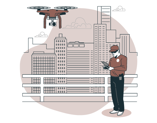
9. How can drones help in urban planning?

New-age drones help us with important data that can aid us in building cities and developing communities. This also remains one of the frequently asked questions because here’s where drones play a major part. The accurate 3D models and geo reference data can help with vector road maps, terrain assessments, land compatibility for different operations, 2D orthomosaic urban-rural classification, and corridor mapping.

10. How accurate are your operations?

At YCSPL, we are equipped with the latest in digital survey technologies and we have dedicated research and development tea, who are continuously working on improving our ventures. We have been contributing immensely to the areas of GIS planning, urban development, property management, and other governmental plans.

11. How long can a drone fly?

The flight time of a drone usually depends on a lot of factors like the drone configurations, weather conditions, and payload specifications. Generally, they can fly anywhere between ten minutes and thirty minutes. But this short flight period is more than enough to collect all the information that you deploy the drone for.

With the drones at YCSPL, you’d be able to reduce your manpower and take care of every data you want to source in a concise period.

12. How fast can a drone fly?

Consumer drones foes up to an average speed of 40-50mph while there are some drone categories where they’re deployed at up to even 70mph. There are also specifically designed racing drones that can go up to 100mph.

Different types of concepts involved in urban planning
August 18, 2022 /

The types of urban planning concepts that every designer or architect should know

The major scope of urban planning is to breathe life into cities and enrich the well-being of the citizen. The core focus here is to develop sustainable communities with ample opportunities. There are different types of urban planning concept and the major idea of all these revolves around developing cities for the future.

Urban planning designs and concept ideas should revolve around promoting city-life features like easy access, enhanced engagement avenues, and living a busy life while also having areas for refreshments. Everything from economic growth, effective utilization of public spaces, construction designs, infrastructure developments, social functions, availability of resources, etc should all be taken into consideration.

All these elements can be categorized and can be dissected into different urban planning concepts as listed below

But firstly, it is important to understand that all these elements co-relate with each other and should be considered to go hand-in-hand. Only this way, we’d have the chance of building cities that are comprehensively sufficient to meet the growing needs of the citizens. If you’re looking at the concepts, you should also be curious about what is urban planning. Because creating a community might be one effort but restoring an existing one also involves its own nitty-gritty that needs to be addressed.

1. Strategic urban planning

Any planning can only meet the desired outcomes if they have any set high-level objectives from the start. A strategic planning process involves the consideration of elements that will enhance the quality of life altogether. This should focus on enticing people from even other regions to migrate to live the city life that the urban area offers.

Features like transit facilities within the city, creating more open spaces, developing communal spaces, etc. The other components involved here should be revolving around the uniformity of the design elements and give a particular theme to the city in question.

2. Land-use planning and development

This predominantly involves policy regulation and devising laws for land utilization planning. There should be proper planning in a place where urban developers contribute toward governmental laws, rules, codes, and regulations that can impact land usage.

The planning here should be carefully done for addressing the issues surrounding the development of infrastructures for municipal tasks or general public usage. There should always be a clean line that’s drawn for preserving specific zones or reserve lands either for conservation or later usage. The urban planning of these areas should also be done prior to development. Land utilization may be residential, commercial, industrial, or municipal.

Residential structures involve condos, apartments, or family houses. Commercial structures include spaces like office buildings or retail outlets. Industrial structures include manufacturing facilities, factories, or warehouses. Municipal refers to buildings assorted for government utility like police stations or collector offices.

Land usage planning in collaboration with strategic efforts results in promoting a transparent construction of infrastructures where all the diverse interests and requirements will be met. Urban planning in India generally involved artisans from different sectors working in perfect collaboration with each other.

3. Master planning

Creating plans or blueprints for untouched areas and building on lands that are yet to be developed is what mater planning involves. Envisioning the requirements of the future is what makes master planning a viable effort.  This is one of the significant types of urban planning concept since they decide the direction for future efforts.


what is urban planning

Be it any residential or commercial structures, planners should focus on paying close attention to possible developments in the future like road locations, transportation considerations, etc.

There should also be proper allocation of resources for building amenities for the citizens like communal spaces, public parts, etc.  Government agencies should work closely in association with land owners and experienced urban planners to consider all the potential angles that will accelerate the development. Only this way the completed space will be geared up to satisfy the needs of the future.

4. Revitalization planning

This one is contradictory to the master plan stated above. Because here we deal with uplifting communities and infrastructure of the urban areas that have lost their essence along the way. Simply put, bringing them back from a state of decline to increase interaction and improve opportunities is what we do here.

At YCSPL, we have worked on a few projects in this regard. The root cause for the fall of the urban segment is first identified here. This might be anything from roads that are repaired, to buildings that have become outdated or excessive population growth while stagnant economic prospects.

Developing the infrastructure, adding public spaces, revamping the existing outlooks of the buildings, etc are some of the efforts that are done here. Urban planning in India and revitalization are not as easy as it is on paper. They might even ask for the relocation of communities for further integral developments. But they’re at risk of breaking communal harmony by doing so. Finding a balance here is what urban planners are experienced at.

5. Economic development planning

Cities remain the best option for the working population to migrate to because of the increasing nature of opportunities that they present their citizens with. Economic development is thus important for cities and urban communities to keep flourishing with their financial prosperity. This has a direct effect on the quality of life that it presents people with.

Promoting a ground-floor life is essential for this to happen. This way there will be a lot of local retailers and other talents that find their living thus improving the community around economically. For example, there will be a lot of room for restaurants run by the local population as opposed to franchises. There will be so many avenues for small businesses and thus drive together as one towards growth.

While these are some of the prominent branches and types of urban planning concept, there are a lot of other elements that go into consideration. At YCSPL, we have experts on board who have been working on the sector hands-on for years now.

Which is the most developed city in India?
August 16, 2022 /

Have you wondered about what it takes to be the most developed city in India?

There are over 4000 cities in India according to a census of towns. 48 cities house more than a million people while over 400 cities have a population between 100,000 and 1 million. Everything from infrastructural developments, self-sustainability, water or air quality, and sanitary aspects are necessary for the cities. To rank one of them as the most developed city in India is a crucial aspect. It requires an overall eye for even the smallest of details. We have curated some of the factors that can help us visualize the order of these cities more.

Factors that drive the cities toward development

To answer the question ‘which is the most developed city in India’, we need to look into some of the factors that contribute to the same.

1. Economic powerhouse & GDP contribution

Mumbai is undoubtedly the economic capital of India. Being the most developed metropolis that houses prominent structures. This includes the Bombay Stock Exchange, the Mint, the National Stock Exchange, RBI, etc. The city alone generated a whopping $209 billion in GDP. Mumbai also ranks 29th in the whole world in terms of urban settlements.

2. Health infrastructure

Health infrastructure refers to the availability of medical facilities and immediate access to healthcare as required. Pune ranks on top in this respect. The overall considerations here revolve around the availability of hospital beds, air quality, access to fresh water sources, etc. Pune holds 3.5 hospital beds per 1000 people. Ahmedabad following a close second offers 3.2 hospital beds per 1000 people.

3. Technological growth

Banglore, the Silicon Valley of India is the city that contributes the largest to the IT sector. There are accelerated opportunities for small businesses and the city also houses a lot of major tech companies. There are headquarters of many organizations here including ISRO, Infosys, Wipro, etc. They generate a total GDP of over 400,000 crores and it is even the 84th most developed city in the world.

4. Happiness index

A quantitative study back in 2020 was conducted among the top 16 cities in India. The respondents of the majority found to be the happiest in Chandigarh among the others as the most developed city in India in this regard. Passion, pursuit, pleasure, and purpose were the foundational aspects behind the ranking of the happiness index that determine city development.

Passion reflects the connection between people, quality of relationships, and general engagement of the community. Pursuit refers to the ambitions that people set for themselves and their relentless strife towards it which gives them a sense of belonging. Pleasure refers to a temporary sense of high which can happen in terms of socializing or having a neat work-life balance. Purpose reflects someone’s progress in life. This can be in terms of lifestyle, financial status, and materialistic possessions.

5. Employability

Employability refers to not just landing a job but the diversity of the opportunities available. Bangalore tops the list here as well since they open doors to a plethora of job positions. The city is also great in terms of work-life balance since they house a lot of structures that offer more room for socializing. It thus remains the best city to work and live in.

Which is the most developed city in India

6. Ease of living

Ease of Living is an assessment that comprehensively understands the quality of life and living. Factors like urban development contribute to this index. Economic ability, employment opportunities, sustainability, and available services. A 15-minute city has been the premise of urban development these days where every citizen finds all the necessary things of life sustenance within a 15-minute walking distance.

The city’s administration, political perception, and liberal viewpoints also contribute to this. Consequently, only cities that are inclusive in nature find a place here. In the Million plus population category, Bangalore tops the list. In the less than million categories, Shimla remains the top city when it comes to the ease of living index.

7. Safety index

Chennai remains the safest city in India according to the reduced crime rates, safety for women, ease of living without fear, etc. The city also remains a growing hub of technology housing a lot of artisans who all feel safe in their shoes.

There is no one box or category where you can name the city as the best in the country. But these driving factors make it a little more to understand the hierarchy of the most developed city list.

In hindsight, the top ten developed cities in India would be as follows:

  • Mumbai, Maharashtra
  • New Delhi, Delhi
  • Kolkata, West Bengal
  • Bangalore, Karnataka
  • Hyderabad, Andhra Pradesh
  • Chennai, Tamil Nadu
  • Ahmedabad, Gujarat
  • Pune, Maharashtra
  • Surat, Gujarat
  • Vishakhapatnam, Andhra Pradesh

Urban planning and development are happening almost everywhere in the country. This is driven towards making our cities more sustainable, growth-focused, community building and self-sufficient. At YCSPL, we have been closely working with the government and organizations belonging to the public sector to accelerate the construction of smart cities. Building a developed city in India is only possible with structural growth assistance.

Technological progression is happening beyond our comprehension and we need to stay on track if we want to truly develop as a nation. Companies like ours are getting their hands on the best innovations around to design infrastructures that are technologically accelerated.

Industrial verticals that utilize Geographic Information System(GIS)
August 13, 2022 /

Have you ever wondered why industries use GIS in abundance these days?

Innovative technologies are now the center of any business there is. Professionals should stay ahead of the curve and keep an eye open. They should try their hand at any new updates in the market that has the potential to help you level up. This will help businesses with a competitive edge in the marketplace. Locational awareness can enable businesses to understand a lot of crucial analytics all the better. This is the reason why industries use GIS which will help them analyze data effortlessly.

Environmental data can help with a lot of logistical understanding. The data intelligence availed from GIS sources can help businesses with strategic decision-making. As a result, GIS helps with geospatial data such as demographic, topographic understanding, and thorough analysis of the environmental conditions. They also help understand the compatibility of your vision in the particular region and power further developments.

Before we dwell on all the industries that are effectively utilizing GIS planning, we should understand how these resources are advantageous. Geographic Information systems can effectively offer the following merits. They can

  • Improve resource planning and allocation
  • Risk management and disaster aversion
  • Management of natural resources
  • Save the cost involved in data planning
  • Understand and manage the availability of natural resources
  • Provides a framework for the information systems
  • Better crisis management strategies

Some of the industries using GIS include:

Governmental planning

Firstly, Geographic understanding is crucial for governmental bodies to make informed decisions to ensure the well-being of the citizens. Disaster mitigation is one of the major areas where GIS proves resourceful. GIS utility tools help in spatial understanding that will help us understand areas that are low-lying, localities. This gives us a picture of areas that are at risk of landslides or floods, etc. Governmental bodies will then be able to go about their population relocation strategies accordingly.

Apart from emergency response and management, they can also help with other crucial information. These include the identification of land compatibility for crop planning, territory management, urban planning, resource allocation, up-to-date street information, etc.

Integrated with drone survey technologies, they help in complete terrain assessments, boundary management, and complete surveillance.

Retail

GIS planning can effectively determine the demographic data of any locality and understand crucial insights into customer behavior. You can understand the locational disposition of your customer, their central points of focus, general commuting pathways, etc. All these might help you determine the best location for positioning your storefront.

If you’re looking at prospective business expansion, you need to focus on occupancy density and the pre-defined point of interest (POI) of your customers before diving in. GIS can help you with just this.

Banking

The banking sector revolves around making strategic plans. Even the positioning of a bank in a region is now done after GIS understanding of the locality. This will dissect crucial information like customer disposition, investing potential, economic positions, crime rates in the region for safe operations, etc.

Disease surveillance

The pandemic has shaken the world over the past years and brought the entire world to an economic standstill. GIS sources have been widely utilized by governmental bodies to mitigate the impact of diseases and epidemics. Understanding the relationships of communities, their distribution, and settlements can help in the better picturization of a locality.

You can also affect preventive measures like vaccination, screening, or isolation by understanding these metrics. Epidemiologists utilize GIS services for clustering, interpolation, spatial smoothing & regression. The spatial analysis also presents a detailed picture of high-risk areas where suitable measures can be deployed accordingly.

Telecom

industries using GIS

With the advent of 5G wireless technologies, the doorways to a new world of opportunities are now open. Telecom companies are efficiently utilizing GIS tools to understand the competitive terrain and navigate through the technicalities. By dissecting populations and their distribution to understand site selection for reaching an edge in this cutthroat market scenario. Other factors like service accessibility, understanding local regulations, population density, customer bases, etc can all be visualized with GIS operations.

Agriculture

Agricultural industries utilize GIS for complete data dissection of areas for further crop selection and robust planning. GIS helps in land analysis, visualizing field data, resource identification, and crop rotation planning. They also help with terrain assessment for determining agricultural compatibility in newly selected areas to prevent any errors. Water availability and weather assessments for futuristic planning are also now possible.

Transportation

Logistics and transportation companies dissect GIS data for informed planning. GIS also aids in Ridership analysis, accident analysis, route planning, highway maintenance, traffic modeling, etc

Consequently, they help in minimizing operational hazards and hindrances to carry out a smooth transit from start to finish.

Insurance

Determination of risk and their associated predictions of high accuracy are the driving factors that insurance companies rely on. Some regions risk natural disasters like earthquakes, landslides, floods, or hurricanes. Because of this, they reach out to any GIS company to identify these factors to map risk levels according to historical records, demographics, or local geography.

This will help them with better fund allocation, resource planning, and operational management.

At YCSPL, we have been working on crucial developments pertaining to GIS systems and are finding new areas of industrial utility each day. Our professionals carry decades’ worth of experience to deploy the perfect technical solutions for any requirements you might have along the way.

We have worked both with the public and private sectors for various projects centered around GIS planning.

Top 10 fundamental elements of urban design
August 11, 2022 /

Elements of urban design that are increasingly turning heads and grasping the attention

Urban planning concepts are now increasingly revolving around reducing carbon footprint, improving humanitarian collaborations, developing net-aero neighborhoods, passive solar gain, etc. The world is moving on toward rapid urbanization. This is because of the increasing population and since this migration favors economic uplifts. We should try and refine various design elements to accommodate different geographies, specific cultural environments, climatic considerations, sustainability, and economic accessibility for al. This can shape the fabric of any city with proper elements of urban design.

The new-age urban design concepts that city planners are increasingly adhering to include:

1. People-first designs

Shaping the cityscape structures through human-centric designs that value the seamless participation of the community in the area is important. They should have features like easy access to amenities. Cities must provide access to everything from work or play within the region. We should scale structural plans to offer people a satisfying life experience and a seamless shift.

Meeting the growing needs of the people is what designs are for. We must consider every variable like the ease of mobility, space for leisure and relaxation, work opportunities that are not too far away, etc. All the fundamentals of city planning should unlock what we deem today as ‘smart cities. But be aware to also not compromise the wellness and well-being of the communities.

Only by considering people as the heart of urban planning companies, we’ll be able to arrive at solutions that can be deemed as smart cities with a soul.

2. Uniformity across a diverse mix

The cultural differences between people are deepening in an urban setting with cities now being integrated like never before. Every people in a locality might feel a sense of belonging. Designers should focus on developing urban communities by blurring boundaries of personal indifferences. The concepts that we rely on should be in such a way that they seamlessly accommodated people of every age, income, ability, and race. The concepts we foundationally build on top should also respond to the climatic conditions, locus, the nuance of the culture, and personal identity. We should retain the essence of the neighborhood while also making it more relevant to the needs of the present and future.

3. Balanced movement

Urbanism concepts that we go for should be intelligent enough to accommodate the needs of integrated transport systems. This will maintain a balance between different modes like cycling, driving, walking, railway access, or bus. The free flow of movement would be the core foundation of a well-planned metropolis. And this ease of accessibility through diverse mediums of transportation would bring about a social and economic balance by mobilizing the entire community accordingly.

4. Opportunity matrix

Cities are a potential powerhouse of economic growth since they’re agglomerated with opportunities everywhere you turn. People need to have enough avenues where they can put their skills to value. There should be an inclusive landscape where the workforce belonging to any sector find ample opportunities. The population should drive themselves to an improved financial stature that fulfills their reason for migration. There should be open access to healthcare systems and enhanced chances of employment in their particular neighborhood.

5. Curated street life experience

A ground-floor experience is crucial for creating a balance and offering a multitude of use cases. This is one of the top elements of urban design that can increase accessibility and improve business aspects pertaining to the retail and food sectors. They make the entire cityscape commercially viable. It also makes the entire area look more diverse with a unique experience. They also add up to creating eye-level landmarks, and key focal points, enhance footfalls and accelerated the overall shopping experience that is popular with city life.

6. Outdoor communities

The one particular element that dulls city experiences is the reduced time that people spend in touch with nature but to mobilize a crowd that is communally satisfied and enriched in their overall well-being start with the utilization of quality public spaces. This can be anything from courtyards, parks, or gardens alongside commercial structures. Connectivity with fellow human beings and natural elements can empower citizens with a break when they need it. They also feel a lot closer to nature. Well-conceived pubic realms should be one of the major elements of urban design.

7. Appropriate tech add-ons

Urban design principles should emphasize modern techniques of construction and infrastructural systems. There should be a choice made between capital-intensive methods or labor-intensive methods during the different stages of building according to the situation, circumstances, and the setting of the locality.

8. Balance with nature

An ecological balance is necessary to build a community that is resourceful, viable, and sustainable. This has been the principal driving factor behind all our efforts at YCPL. We want to curate cityscapes that do not exploit every resource we have in the name of urbanization. There should be proper pre-planned avenues that go hand in hand with nature’s ability to replenish itself. Only this will provide us with a sustainable flow of resources to fall back on.

fundamentals of urban designWe should empathize with areas that are fragile, identify zones that threaten the balance of our ecosystem, curate open space designs, and improve avenues for proper conservation.

9. Creating interactive societies

Conviviality – is the concept that revolves around promoting the interaction of society through public domains. There should be avenues that promote people meeting one another. We should create spaces for indulging in activities that can make them more social with one another. This will create a vibrant society where people also empathize with each other in the case of any impending disasters where they need to lift each other up. Any urban planning company should be relying on the importance of these as much as they prioritize infrastructure developments.

10. Vertical layering

The more space available, the better will be the overall access to amenities. Innovative urban planning ideas are now progressive towards improving the diverse experience within a single building. This thus takes the pressure off the streets. Meaningful floor plans and elevated design can contribute to the overall structural aesthetic of the cities while also accommodating the increased need for utility space in densely populated areas.

YCSPL has been successfully working over the years in bringing all these core principles to life in every design we curate!

What is a drone survey?   
August 10, 2022 /

Everything you need to know about drone survey

Surveying in general involves measuring the end-to-end of an area before the beginning of any construction project. Drone survey typically aids in aerial monitoring and measuring with an integrated payload. Through high-definition photos captured by a downward-facing camera, it enables visualization of the entire property boundaries from an aerial viewpoint. This information helps in informed decision-making to upkeep infrastructures. In addition, they also help with construction planning and the delineation of property boundaries.

Aerial photographs captured at different angles collect a rich pool of information and geo-references. They accumulate thousands of data points that are precise in detail. This further allows the developers to create accurate 3D models before beginning their construction efforts. This visualization gives them an upper hand that other traditional surveying technologies do not come close to offering. The drone survey also presents accurate volumetric measurements. They can thus help in the creation of maps or property boundaries that are on point.

How does an aerial survey work?

Drones capture information from the above by using multispectral and RGB cameras. There are also drones that carry LiDAR sensors (Light Detection and Ranging). These utilize the application of lasers to collect data sources that can be further developed into accurate 3D models.

Previously, the data collected by drones needs processing. Post landing, the operator retrieves this data. But drones have come a long way now and it now enables a free flow of data in real-time. All the collected data points offer actionable information by coupling them with Geographic Information Systems. Making sense of the raw data even when the drone is still flying is now possible.

Deliverable outcomes that drones offer:

Orthomosaic Map:

These are maps that are created for larger surface areas by distorting and stitching together a sequence of images that are captured by the drone. They are geometrically corrected to offer 2D information like a map that is precise to every pixel.

3D point cloud:

Drone survey technologies generated densified point clouds with accurate geospatial coordinates of high accuracy. They help in measuring horizontal distances, surface area, and even volumetric measurements.

3D Textured Mesh:

They present a surface composed of triangles. The edged, texture, and faces of an area shot by the drone are implemented into the vertices of a triangle. This minimizes the distance between selective points pertaining to the point cloud. They are heavily utilized for visual inspection of varying scales.

Digital Surface Models (DSM):

Drone images carry 2D information along with altitude values. This gives us three-dimensional geospatial coordination that can help create DSM models of any area.

Digital Terrain Models (DTM):

Drone data can also create topographic models of the surveyed landscape. They are effectively utilized in the areas of land-use analysis, geological applications, environmental studies, flood/other natural disaster mitigation, etc.

Contour lines:

By processing the DTM and DSM models, we can arrive at contour intervals. This can be further projected into a map of contour lines to give a better understanding of the surfaces that are being aerially surveyed.

How accurate is the drone survey data?

aerial survey

The performance of a drone and the accuracy of the data it offers depend on various components. This includes camera resolutions, the height of inspection, vegetation, and even the utilization of software tools for the geolocation of aerial images. The GPS data powered by drones only report up to +- 10m accuracy. But the data is further calibrated at the ground control points to locate points that offer +-1cm accuracy. Under optimal conditions, high-end surveying drones offer absolute precision.

Advantages of surveying with drones:

Accuracy

Rapid improvements in UAV technologies have now enabled payload integrations that feature 5.2k image and video resolutions. This greater pixel density maximized the overall accuracy of the captured data point. Incorporated with GIS and GPS systems, they aid in accurate 3D maps and models that are extremely reliable. In addition, drones are now developed with a range of stabilization techniques. This makes them operable under any challenging weather conditions or rough terrains.

Economic viability

They eliminate the need for exhaustive resources and overhead costs since they carry out operations from the open horizon. They also curb the need for flying a helicopter or light aircraft for surveying purposes which are highly cost-intensive. Drone survey prices are also going down due to the combination of rapid commercialization. They also offer ease of data processing in recent times eliminating the need for extensive resources.

Speed

Commercial drones have gained a lot of attention in recent times. This is because of the flexibility they offer in terms of covering extremely large surface areas. And they do it in a relatively shorter period of time compared to any other method.

Drone survey services also deliver precise results in just a matter of minutes which offers a solution for time-sensitive projects.

Access any subject

UAVs make it easier for aerial analysis of practically any subject at any altitude there is. At YCSPL, we have worked on a wide range of projects that required remote access to inaccessible terrains.

A well-planned out flightpath and an experienced pilot in the picture can handle drone deployment in any remote area. Since drones enable up to 30x zoom, they can be put into use for the inspection of any subject.

YCSPL has been relentlessly working on our research and development to deploy drones of maximum efficiency to meet the data needs of any industry vertical!

What is a geographic information system (GIS)?
August 9, 2022 /

Everything you need to know about Geographic Information System

GIS has been changing the way our world works by solving complex problems with the simplest of solutions. Geographic Information System stores, analyses, and manages diverse data sources and maps all these data to help aid better visualization. GIS helps us with a foundational understanding of any data in a geographic context. As a result, they help us to establish patterns or relationships. This understanding can help businesses belonging to diverse industrial sectors. We can make a thorough sense of any data that they accumulate.

They are a powerful utility resource that can help businesses with informed decision-making tools. It can also help in a complete understanding of environmental, topographic, and demographic data. GIS applications carry extensive data intelligence. They help with various industrial applications.

How does it work?

GIS helps in arriving at actionable intelligence from any data source. We can chart them as layers to arrive at a map out of which we can derive a better sense of the collected data. Geospatial analysis is employed to resolve complex problems.

Any GIS company will have professionals belonging to diverse disciplines including cartographers, programmers, spatial analysts, database managers, remote sensing specialists, land surveyors, etc. They can offer comprehensive end-to-end assistance.

GIS data comprises thematic layers and they include two major types:

Vector:

They are main points, polygons, and lines. Contour lines and data pertaining to administrative boundaries come under the vector category.

Raster:

These are in a grid format.  Since the data here is stored in the format of rows and columns that are discrete or continuous in nature. Land cover and temperature distribution can be common examples.

What is the common use case of Geographic Information System?

GIS has been powering millions of operations around the world and it’s making noticeable impacts in every sector there is. Commonly, it is now used in areas like:

Mapping and navigation:

What’s a better way to explain the visual data interpretations that GIS offers if not for taking a look at google maps? It’s a web-based GIS solution that has been helping us consistently with smart mapping for everyday navigation purposes. GIS is also employed for smart mapping technologies since they are handy for property management of commercial sectors.

Urban planning:

GIS data helps in the thorough visualization of trends and socio-economic patterns of settlements. Consequently, they help drive further efforts towards thorough urban growth in the direction of sustainable expansion. This aids in the discovery of all the factors and environmental conditions that can drive successful constructions.

gis company

At YCSPL, we have worked in association with a lot of governmental organizations. We have worked on smart urban planning solutions that are time-tested and ecologically considerate.

Disaster mitigation and management:

A thorough assessment of the geospatial models of a locality and environmental monitoring can help in disaster management, mitigation, and even recovery. For example, let’s take the case of cyclones or severe flooding/ GIS maps will help you with a clear-cut picturization of the location to understand the low-lying areas that might need relocation. This will help save lives and there are a lot of disasters like these that are prevented through GIS solutions.

Community development:

Building communities and assisting them with self-sustainable infrastructures. (like developing a ’15-minute city’ where all the utility resources are less than a fifteen-minute ride away). This is what extensive GIS services can do. They can be effectively utilized for extensive planning and drive efforts towards building better communities.

Geological application:

Geologists are now employing GIS for carrying out detailed soil analysis, and composition assessments, carrying out an assessment of seismic information, and arriving at 3D models for the depiction of geographic features. We can also identify rock characteristics which will give us a clear picture of their mineral composition.

Asset management:

GIS planning helps organizations and even the government plan every detail. And as a result, they utilize the finite resources within their reach more efficiently. We can understand all about the populations at risk and the allocation of resources better through these.

Agricultural developments:

Geographic Information systems can help in food production Also, they aid in better farming through comprehensive farming assessments and pre-requisite environmental conditions to assist the planned crops. Monitoring crop rotations, analyzing and preventing surface-run-offs, etc. This can help resolve the global food shortage.

Telecom and network services:

Geographic data analysis can dig deeper into the complex networking structure, optimized placements, planning, and overall maintenance. This aids in better overall location-based services.

Accidental hotspot analysis:

GIS data helps in identifying crucial locations that are accident-prone areas. With assisted data intelligence, it enables easy implementation of road safety measures and better traffic management.

Analytical surveying:

Geographic Information Systems have shaped Global Navigation Satellite Systems (GNSS). GIS also enables location sensing of any remote object anywhere on earth. It can also help with thorough estimation and mapping of any given area to arrive at a structural understanding. They are especially useful in the areas of mining and even in the oil & gas sectors.

YCSPL has been employing industry experts to offer end-to-end GIS planning, consulting, and deployment solutions for businesses belonging to diverse verticals. Geo processing, geocoding, GIS survey, data collection and processing, and custom geospatial development are all some of the services that we offer thorough support and solutions for.

Contact us to make your vision for business expansion a possibility with data-assisted decision-making!

What is the difference between architecture and design?
August 8, 2022 /

There are significant differences between architecture and design that you should know about!

Architecture is essentially a type of design. While architecture deal with the structural plan of something, design is a plan that is employed to create something. For example, let’s take a building. While the exterior structures require an architectural plan, the interiors are rather designed separately. Architecture deals with abstract structures like the construction of rooms that can accommodate a lot of designs. While design rather deals with the creation of concrete utilities and functional structures like meeting rooms in an office space. Knowing the difference between architecture and design will give you a crisp picture of all the construction aspects as a whole.

How does the scope of work differ between an architect and a designer?

Architecture deals with abstract elements like strategy, purpose, and structures. Design on the other hand inclines more toward concrete implementation. Similarly, architecture curates schematic representation for the construction of structures. A designer rather focuses on enriching the overall experience of the structures and creating them to be more lively.

Only when both of these niches merge into one and the professionals handling these work in alignment with each other. The overall value of the construction will scale up this way. A flair for design, an eye for details, and an artistic understanding are what will help bring any project to life.

There is also a significant difference between architects and designers compared to that civil engineers. While the former deals with the visualization of the construction, the latter deals with the design-to-completion procedures. They bring the design to a concrete standing.

Some of the examples of architecture include:

  • Building architecture
  • Enterprise architecture
  • Data architecture
  • Business architecture
  • Animation architecture
  • Technical architecture
  • Brand architecture

Some of the examples of design include:

  • Interior design
  • Visual design
  • Technology design
  • User Interface design
  • Web design
  • Experience design
  • Product design

How are architecture and design impacting society?

architecture and design

Architectural designs have been the age-long representation of society that reflect the lifestyle of civilizations. Consider the monumental designs that trace back centuries. Or even the new-age contemporary construction; the style of architecture and its pattern of construction open a wide door for interpretation and understanding of history over time. Understand the environment of the past and compare them to modern-day developments. You can understand the clear-cut impact that architecture has on society along with the evolution in our design thinking. Modern-day concepts are shifting their core focus from surface-level appearance. They are dwelling deeper into matters like sustainability and functionality. This will create environments that are in touch with nature.

Be it the habitability, aesthetics, ease of construction, or environmental compliance, companies that offer architecture services pay keen attention to all these details before diving all in. The designs that are developed go a long way beyond just the way it looks. There are considerations like how the design fits with the environment, cultural considerations, etc that are paid close attention to.

They go hand in hand:

Architecture and design services together incorporate both art and science in an intertwined manner to deliver outputs that are in coherence with the environment and the people. Everything from psychology, socio-economic development of the locality, politics, and sociology needs consideration.

Both architecture and design are valuable in terms of the details they bring to life. The major focus relies on the aestheticism and functionality of the construction. You want to meet your design objectives while also making the overall area functional in every aspect. At YCSPL, we have a team of industry experts who works together in making any project turn out the most efficient way.

What do we offer as an architecture company?

At YCSPL, we have been a leading consulting organization for decades now. We have a rich pool of resources that can efficiently handle a project of any scale belonging to any industry vertical. We have been offering architecture & design services for the construction of both commercial and residential properties including educational institutions, factories, townships, industries, commercial malls, retail outlets, food joints, restaurants, government utility buildings, etc.

All our design plans that we curate are time-tested, risk-aversive, innovation-driven, and suitable to the existing market conditions. Quality assurance and maintaining high standards in the deliverables are why we remain the pioneers in the market.

We go beyond the difference between architecture and design to offer the following outcomes for our clientele:

Concept design:

All the initial objectives, project scope, and goals are all taken into consideration for the illustration of preliminary designs and the first draft. We’ll then listen to the client’s feedback to tweak our designs accordingly in the subsequent stages.

Execution design:

The approved design is developed for the construction of blueprints, bidding specifications, permits, and technical notes. And before we enter the final phase of construction, we’ll work on annotated floor plans, exterior elevations, structural plans, dimensions, and details.

Preliminary design:

Here the architects and designers together interact and prepare a detailed design brief. All the necessary site analysis, precise calculations, understanding and resolving constraints, budget specifications, and timelines are important here.

Schematic design:

The overall demonstration of architectural and design ideas happens here.

Are you having a project idea, goals, and vision? Our experts can offer you all the technical assistance you need to give your construction the life it needs.

Advantages of drone survey
August 4, 2022 /

The advantages of drone surveys can open up enormous opportunities!

The surveying sector is rapidly flourishing with the advent of new-age drone technologies and they’re proving essential for topographical surveying. They open doors to GIS planning, aerial photogrammetry, aerial videos, infrastructure inspections, property surveys, 3D site modeling, etc with a bird-eye view. Unmanned Aerial Systems (UAS) fitted with high-res cameras, payloads and GPS technology offer an entirely new approach with enhanced accuracy for various operational assistance in the areas of construction, civil engineering design, and land surveying. The advantages of drone survey are plenty and to harness them for your business utility, you need to have deep subject-matter expertise on the application.

So, what are the benefits of drone surveys?

 1. Reduced field times

If you’re looking to perform extensive surveys for larger commercial properties, drones can help you with effective aerial inspection solutions. This could reduce the redundancy that comes with manual surveying which could take up a long time, even weeks at a stretch. Apart from being an operational burden that can hinder your workflow, this could also be exhaustive on your resources, labor, time, and money involved. Drone surveying can thus open your business to a plethora of opportunities and also deliver results with quicker turn-around times. It is also about five times quicker than any land-based method of surveying.

2. Accurate and exhaustive data rendering

One drone flight might be everything it takes to track a lot of metrics and data points altogether. A lot of measurements can also be reiterated to different formats like point cloud, Digital Terrain Models (DTM) and Surface (DTS), contour lines, 3D models, geospatial analysis, etc.

Advantages of digital survey

Aerial surveying will also provide you with a keen eye for attention to detail above. This will prove efficient, especially during any constructional development projects. They also provide a broader avenue.

3. Map areas that are otherwise inaccessible

There is no hindrance anymore in terms of difficult terrains, steep slopes, and hard-to-reach or inaccessible areas when you deploy drones for the mission. This makes it a perfect tool for aerial mapping, terrain assessments, surveillance, traffic monitoring, property assessments, etc with no sweat.

4. Poses no hindrance to workflow or operations

Take railway tracks or a highway, how do you monitor them without hindering their continuous operations? Well, drones can do that for you. The aerial capture efficiency of drones makes it easier for continuous monitoring and surveying operations to proceed without interference.

5. Reduced manpower

Traditional survey operations require too many professionals on-site with each of them carrying a diverse experience profile and subject-matter knowledge. The application of drone survey services can bypass this problem and do any surveys with a lot less need for resources.

6. Volumetric measurements

Drone technologies help with 3D models and mapping that will help us arrive at volumetric measurements with topographic data thus making these digital surveys more accurate. This is quicker and a lot more economic than the other methods of volumetric calculations. Stockpile calculation is also much more precise with drone operations. And since drones can be deployed aerially and capture the data from above, they’ll also pose no hindrance to day-to-day operations.

7. Well-planned out urban planning

The future of the cityscape is going to demand a lot of resources and urban areas should be well-equipped to handle the influx of these. Thanks to drones, urban planners will be equipped to collect a lot of information within shorter time periods with lesser resources. Everything from environmental conditions, landscape analysis, structural planning, etc can all be precisely measured and developed for further planning.

8. Health & safety

Drones make it easier to even access the most remote areas while also ensuring uncompromised safety. They can carry out seamless operations without any interference even in the most sensitive environments and this is one of the top advantages of drone surveys. This also negates the possibility of any disasters in the workplace and also eliminated the need for extensive safety planning. Drones thus help in quicker turnaround times compared to the traditional methods of surveillance.

9. Access any subject

At YCSPL, we deploy drone assistance for various surveillance and monitoring operations. They’re also extensively utilized for defense and border security operations with appropriate payload configurations. The payloads are also extremely efficient with about 30x zoom capacities that enable precise inspection of any subject.

YSCPL has been providing a vast range of drone surveying services for businesses belonging to both the public and private sectors. We deploy the most refined methods of surveying to provide you with real-time data solutions. Our experts are handy with 360-degree solutions that can gain you momentum in accelerating your business processes dynamically in all directions. We break away from the age-old problems of surveying with out-of-the-box solutions.

Our state-of-the-art technologies have helped us work on projects belonging to diverse areas like urban planning, archaeological surveying, property surveillance and management, land surveying, terrain assessment, construction development, etc.

New-age urban planning ideas to watch out for in 2022
August 1, 2022 /

Urban planning ideas that might just redefine the future of our cities!

New age urbanism and even the foundational processes of its conceptualization are now rapidly progressing from a panoramic viewpoint. Any community or civilization is only shaped by the flow of ideas. The recent advancements of urbanism are a life-like example of how ideas can bring in a drastic shift in our way of life. Sustainable considerations should drive urban planning ideas. This is what we need to steer our cities for the better.

Cities are the growth engine that potentially churns about 80% of the global GDP. And they also remain a huge catch for fishing talents and bringing in investment. But urbanization also brings in its own challenges that need proper addressing. Widening economic inequality, alarming rates of pollution, high traffic rates that calls for the construction of new structures, transportation requirements, etc should all be addressed in order to make a city self-sufficient and sustainable. There should also be proper planning in place to create more opportunities. Only this can help the urban poor improve their lifestyle.

Innovative ideas that have taken the spotlight in recent times include:

Green planning

Urbanization is our only beacon of hope for creating enriched societies that can flourish with an abundance of growth avenues. But it is also imperative that we make way for all of these in a sustainable fashion.

Climate change and its associated complications are at the risk of pushing over 77 million urban residents below the poverty line worldwide. But what happens next and how urbanization affects the livelihood of its people is still up to us if we act smart and soon.

Cityscapes go hand-in-hand with green infrastructures that will help us thrive. Sustainability is the core foundation. Making conscious developments that are in adherence to all the green protocols is a priority. Any new corridor or public utility space can be created into a green space. Only this will help in bringing about a healthy urban living environment.

We can achieve ecosystem resilience to tackle the ever-expanding populations, availability of resources, and the impact of global climate change through this. Decarbonization should be a driving agenda for any urban planning company.

Creating green spaces like public parks will help citizens foster a connection with nature despite the high population density around.

Developing an ecosystem enriched for healthcare and accessibility

Innovative urban planning ideas

Early intervention and prevention should be the core focus of the cities to help the well-being of the citizens. If the pandemic has left us with many lessons, it is mostly the realization that any population-dense area can be put in a vulnerable spot; This is if we don’t have a localized plan of action for ensuring the well-being of the citizens. It holds true even in the case of health care emergencies or a mass outbreak.

There should be a developed ecosystem where healthcare reaches beyond the walls of a hospital. We need proper urban planning interventions in place. This will ensure that the urban communities remain in a safe and hygienic environment.

The ’15-minute’ city

At YCSPL, we’ve handled urban planning projects of higher scales, and here’s a look at the insights from the insider on why we need 15-minute cities.

A decentralized urban development model will ensure citizens find every amenity by taking a 15-minute walk. This will help us indirectly towards sustainability. This is because they negate the need for driving a bike or car for longer distances; thereby reducing our net carbon emissions. These localized neighborhoods will harbor a better sense of connection among the residents. It also instills a sense of community within them. Hyper localization should be our goal for the near future. We should plan our developments revolving around this.

Planning inclusive developments

Cities witness the influx of mass migration of populations from diverse backgrounds. These localities should be the premise where we fight inequalities. This will create a society that is driven by a sense of belonging. It is also fundamental that will create a level-playing field for the masses to create equal opportunities.  Communal coexistence and economic inclusion are why cities started getting their popularity in the first place.

Inclusive developments should include the consideration of people to make every amenity accessible as we go about urban planning. Gender-neutral bathrooms, wheelchair amenities along with ramps in the common places, accessible spaces for the elderly, etc are all important. You should consider these before beginning the construction of any new infrastructural developments. This will help create social justice among the citizens which will there again enhance their overall happiness quotient.

Cyber security and privacy awareness

We started bracing up the past decade to tackle any health crisis. Cities are more or less successfully getting through it all. But the core concern is data privacy and gearing up cities to safeguard themselves against any imminent cyber-attacks. Because data is now the most precious commodity of the cities.

You need security experts 24/7 who can potentially identify, detect and mitigate any invasive data attacks. This is especially handy to take care of any new key development. (like public wifis or free hotspots in common areas)

Urbanization and digital dependency have made cities highly interconnected. They are complex environments with a need for a lot of upgrades and eventual enhancements. Data privacy should be a core consideration during the deployment of any new innovative structures.

There is a whole new avenue of urban planning ideas. All of them need proper planning along with the consideration of all the surrounding factors.

What does your city mean to you? How far would you go to save the future of it? The stakes of urbanization are at their peak but so should the society’s commitment toward sustainability.

Here’s a quick gist at some of the urban planning projects that we have handled at YCSPL with one core purpose – to create futuristic cities that will turn heads globally!

How can we help you?

Change becomes the most dynamic, powerful source of progress you have

Get in touch with us